To get to Grutas de Tolantongo from Mexico City, you drive 195 km in approximately 4 hours via the Mexico-Pachuca highway, then to Actopan and Ixmiquilpan, and finally 20 km of mountain road down to the canyon. From Queretaro it is 180 km (3.5 hours) and from Pachuca 120 km (2.5 hours). You can arrive by private car or by bus with a transfer in Ixmiquilpan.
What Is the Fastest Route from Mexico City to Tolantongo?
The fastest route from Mexico City to Tolantongo is via the Mexico-Pachuca highway (85D), exit toward Actopan, road to Ixmiquilpan, and from there the state road to San Cristobal-Tolantongo. The total distance is 195 km and takes between 3 hours 30 minutes and 4 hours 30 minutes depending on traffic.
Step by Step from Mexico City
Segment 1: Mexico City to Pachuca (91 km, 1 hour 15 minutes)
- Leave Mexico City via the Mexico-Pachuca highway (85D). You can access it from Indios Verdes, Ecatepec, or Periferico Norte.
- Pass the Ojo de Agua toll booth ($90-110 MXN approx.).
- Continue on the highway toward Pachuca. You do not need to enter the city.
Segment 2: Pachuca to Actopan (37 km, 35 minutes)
- Take the turnoff toward Actopan via the Pachuca-Actopan highway (free or toll). The toll road has a booth of approximately $50 MXN.
- Drive through Actopan following signs toward Ixmiquilpan.
Segment 3: Actopan to Ixmiquilpan (35 km, 30 minutes)
- Federal Highway 85 from Actopan to Ixmiquilpan. Straight road, well paved, 2 lanes per direction.
- When you reach Ixmiquilpan, this is your last chance to: fill up on gas, withdraw cash from an ATM, buy supplies at stores. There are no gas stations or ATMs after this point.
Segment 4: Ixmiquilpan to Tolantongo (32 km, 50-60 minutes)
- From downtown Ixmiquilpan, take the road toward San Cristobal. Follow signs to “Grutas Tolantongo.”
- The first 12 km are a straight road through the Mezquital Valley.
- The last 20 km are the mountain road that descends into the canyon. Tight curves, steep grades of up to 14%, one lane per direction in most sections.
- At the bottom of the descent, you arrive at the park entrance booth.
Toll and Gas Cost Summary from Mexico City
| Item | Approximate Cost 2026 |
|---|---|
| Ojo de Agua toll | $90-110 MXN |
| Pachuca-Actopan toll (paid road) | $50 MXN |
| Total tolls (one way) | $140-160 MXN |
| Total tolls (round trip) | $280-320 MXN |
| Gas (round trip, compact car) | $500-700 MXN |
| Gas (round trip, SUV/pickup) | $800-1,100 MXN |
| Total transportation round trip | $780-1,420 MXN |
GPS Coordinates
- Main entrance Grutas de Tolantongo: 20.64230° N, -98.99190° W
- Ixmiquilpan (reference point): 20.4838° N, -99.2199° W
- Start of mountain road: 20.5150° N, -99.1050° W
Download offline maps on Google Maps or Waze before leaving Ixmiquilpan. Cell phone signal disappears approximately 20 minutes before reaching the park and does not return until you are inside certain areas of the park or when you return to the Mezquital Valley area.
How to Get from Queretaro to Tolantongo?
From Queretaro to Tolantongo is approximately 180 km and the drive takes between 3 hours and 3 hours 30 minutes. The route follows the Queretaro-Mexico highway to the Huichapan turnoff, then to Ixmiquilpan, and finally the mountain road to the grottoes.
Step by Step from Queretaro
Segment 1: Queretaro to Huichapan (95 km, 1 hour 15 minutes)
- Leave Queretaro via highway 57D (Queretaro-Mexico) heading southeast.
- Take the turnoff toward Huichapan/Tula. Toll of approximately $120 MXN.
- Follow the federal road toward Huichapan.
Segment 2: Huichapan to Ixmiquilpan (55 km, 50 minutes)
- From Huichapan take the federal road toward Ixmiquilpan. Two-lane road, well marked.
- After passing through Tasquillo, continue toward Ixmiquilpan.
- Mandatory last stop in Ixmiquilpan: gas, ATM, supplies.
Segment 3: Ixmiquilpan to Tolantongo (32 km, 50-60 minutes)
- Same route as from Mexico City: road to San Cristobal and mountain descent.
Costs from Queretaro
| Item | Approximate Cost 2026 |
|---|---|
| Tolls (one way) | $120-150 MXN |
| Tolls (round trip) | $240-300 MXN |
| Gas (round trip, compact car) | $450-600 MXN |
| Total transportation round trip | $690-900 MXN |
Alternative Route via Zimapan
There is an alternative route that passes through Zimapan instead of Ixmiquilpan. This route is slightly longer (200 km, 4 hours) but offers spectacular scenery crossing the Sierra Gorda of Hidalgo. It is only recommended for vehicles with good suspension and experienced mountain road drivers, as it includes unpaved sections.
How to Get from Pachuca to Tolantongo?
From Pachuca to Tolantongo is 120 km and the drive takes between 2 hours and 2 hours 30 minutes. It is the shortest and most direct route from the three main cities: Pachuca-Actopan highway, federal road to Ixmiquilpan, and the mountain descent into the canyon.
Step by Step from Pachuca
Segment 1: Pachuca to Actopan (37 km, 30 minutes)
- Leave Pachuca via Boulevard Felipe Angeles or the highway toward Actopan.
- If you take the toll road, the booth costs approximately $50 MXN.
Segment 2: Actopan to Ixmiquilpan (35 km, 30 minutes)
- Federal Highway 85, well marked. Semi-arid landscape of the Mezquital Valley.
- Stop in Ixmiquilpan for gas, cash, and supplies.
Segment 3: Ixmiquilpan to Tolantongo (32 km, 50-60 minutes)
- State road to San Cristobal and descent into the canyon.
Costs from Pachuca
| Item | Approximate Cost 2026 |
|---|---|
| Pachuca-Actopan toll (one way) | $50 MXN |
| Toll (round trip) | $100 MXN |
| Gas (round trip, compact car) | $300-400 MXN |
| Total transportation round trip | $400-500 MXN |
Pachuca is the cheapest and fastest option to reach Tolantongo. If you are traveling from a distant city (Guadalajara, Monterrey, etc.), consider flying into Pachuca airport or AIFA and renting a car from there.
Can You Get to Tolantongo by Bus?
Yes, you can get there by public transportation, but there are no direct buses. The route requires a transfer in Ixmiquilpan: first take a bus from your city of origin to Ixmiquilpan, then a shared van or taxi to Grutas de Tolantongo (40-50 additional minutes).
Bus from Mexico City
Option 1: Ovni Terminal (Buenavista)
- Go to the Ovni bus terminal, located near the Buenavista metro station (Line B) and the suburban train.
- Take the bus to Ixmiquilpan. Buses depart approximately every hour from 6:00 a.m. to 8:00 p.m.
- Ticket cost: $180-250 MXN per person (2026).
- Duration: 2 hours 30 minutes to 3 hours.
Option 2: Terminal Norte
- At Terminal del Norte (Northern Bus Terminal), look for the Flecha Roja line or similar going to Ixmiquilpan.
- Similar cost: $200-280 MXN.
- Duration: approximately 3 hours.
From Ixmiquilpan to Tolantongo
- When you arrive at the Ixmiquilpan bus terminal, look for shared vans heading to “Grutas de Tolantongo” or “San Cristobal.” They depart from the municipal market.
- Cost: $50-80 MXN per person.
- Schedule: they leave when full, generally every 30-60 minutes from 7:00 a.m. to 5:00 p.m.
- Alternative: private taxi from Ixmiquilpan, $400-600 MXN for the entire trip (can be shared among 4 people).
Bus from Queretaro
- Queretaro bus terminal, lines heading to Ixmiquilpan (transfer in Huichapan may be needed).
- Cost: $200-300 MXN.
- Duration: 2-3 hours to Ixmiquilpan.
- From Ixmiquilpan, same shared van route.
Bus from Pachuca
- Pachuca bus terminal, line to Ixmiquilpan.
- Cost: $100-150 MXN.
- Duration: 1 hour 30 minutes.
- From Ixmiquilpan, shared van to Tolantongo.
Cost Comparison: Car vs. Bus (1 person, round trip from Mexico City)
| Item | Private Car | Bus + Shared Van |
|---|---|---|
| Tolls / Ticket | $280-320 MXN | $360-500 MXN |
| Gas | $500-700 MXN | Included |
| Shared van Ixmiquilpan-Tolantongo | N/A | $100-160 MXN |
| Total per person | $780-1,420 MXN (split among passengers) | $460-660 MXN |
| Total for 4 people | $195-355 MXN each | $460-660 MXN each |
The conclusion is clear: if you are traveling alone or as a couple, the bus is cheaper. If there are 3 or more people, a private car is cheaper per person and offers more schedule flexibility.
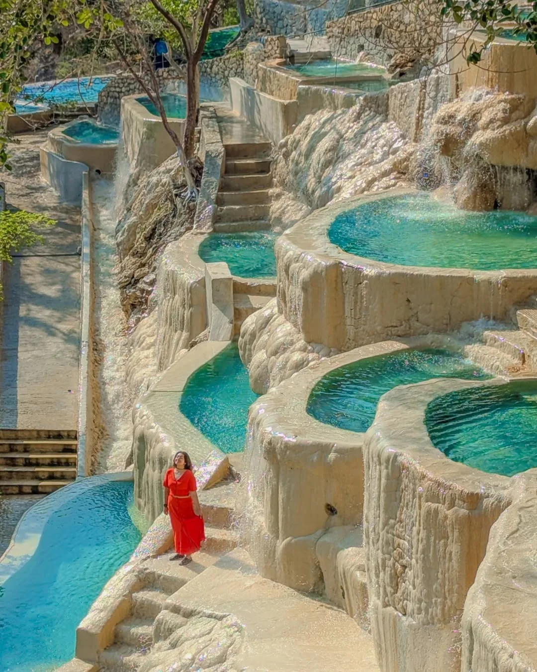
What Is the Mountain Road to Tolantongo Like?
The mountain road descending into the Tolantongo canyon is 20 km long, fully paved, has one lane per direction in most sections, grades of up to 14%, tight curves with no shoulders, and requires driving at 20-30 km/h. It is in acceptable condition but demands the driver’s full attention.
Technical Characteristics of the Road
| Feature | Detail |
|---|---|
| Length | 20 km (from start of descent) |
| Maximum grade | 14% |
| Road width | 5-6 meters (narrow sections) |
| Shoulders | None in most sections |
| Surface | Asphalt with occasional potholes |
| Guardrails | Partial, not at every curve |
| Recommended speed | 20-30 km/h |
| Travel time | 40-50 minutes |
| Suitable for large buses | No |
| Suitable for low-clearance sedans | Yes, with caution |
Tips for Driving the Road
- Use engine braking, not the pedal: use low gears (2nd or 3rd) to control speed on the descent. Continuous pedal braking can overheat the brakes (fade) and lose effectiveness.
- Honk at blind curves: many curves have no visibility of the opposite lane. Honk before each tight curve to alert oncoming vehicles.
- Yield to vehicles going uphill: by local convention, vehicles going downhill should stop at wider sections to let uphill vehicles pass, since starting on an incline is harder.
- Drive during the day: the road has no artificial lighting. Driving at night significantly increases risk. If you stayed late, wait until dawn or use extreme caution.
- Check your brakes before leaving: if your car has worn brakes, do not descend this road. The combination of steep grades and curves requires brakes in good condition.
- Watch the radiator: the climb back up can overheat the engine, especially in cars loaded with passengers and luggage. If the temperature gauge rises, stop in a safe area and let it cool.
Recommended and Not Recommended Vehicles
| Vehicle Type | Recommendation |
|---|---|
| SUV, pickup truck | Ideal, good visibility and traction |
| Compact car (Versa, Aveo, etc.) | Works well, go slowly |
| Sedan (Jetta, Sentra, etc.) | Works, be careful with bumps and potholes |
| Sports car / low clearance | Not recommended, risk of scraping |
| Large family van (Suburban, etc.) | Possible but tight in curves |
| RV / Motorhome | No, too large |
| Motorcycle | Possible but risky on curves with gravel |
When Is There More and Less Traffic on the Road?
Traffic on the road to Tolantongo is minimal Monday through Thursday and concentrates on Friday afternoons (arrivals) and Sunday afternoons (departures). The days with maximum traffic are holiday long weekends and Easter Week, when wait times of up to 2 hours form at the entrance.
Weekly Traffic Patterns
| Day | Peak entry time | Peak exit time | Traffic level |
|---|---|---|---|
| Monday | No peak | No peak | Very low |
| Tuesday | No peak | No peak | Very low |
| Wednesday | No peak | No peak | Low |
| Thursday | No peak | No peak | Low |
| Friday | 2:00-8:00 p.m. | N/A | Medium-high |
| Saturday | 8:00 a.m.-12:00 p.m. | 2:00-5:00 p.m. | High |
| Sunday | 8:00-11:00 a.m. | 1:00-6:00 p.m. | High (departures) |
Peak Traffic Seasons
- Easter Week (March-April): the worst week of the year. 1-3 hour wait lines to enter. 5,000-8,000 daily visitors. Best to avoid entirely.
- November long weekends (Day of the Dead, November 20th): high visitor volume, 30-60 minute waits.
- December 20-January 2: Christmas high season. High volume but spread over more days.
- February-March weekends: medium-high volume, 15-30 minute waits.
To avoid traffic, the best strategy is to arrive Tuesday through Thursday, leaving early (6:00-7:00 a.m.) from your city to be at the entrance by 10:00-11:00 a.m. The road will be virtually empty.
What to Do If Your Car Breaks Down on the Way?
If your car breaks down on the mountain road to Tolantongo, park on the widest available shoulder, turn on your hazard lights, set out reflective triangles, and seek help at the park entrance booth or wait for another vehicle to pass, since there is no cell phone signal in the area.
Step-by-Step Emergency Plan
- Pull over as much as possible: the road is narrow. Look for a wide curve or a pulloff area so you do not block traffic.
- Set up signals: place reflective triangles 50 meters before and after your vehicle. If you do not have any, use large rocks or visible branches.
- Do not try to repair on a steep grade: if you are on a steep slope, secure the car with rocks behind the tires in addition to the parking brake.
- Ask other drivers for help: the flow of cars is steady on weekends. Local drivers usually stop to help.
- Park emergency contact: write down the phone number before losing signal (signal is lost about 20 km from the grottoes).
- Mechanics in Ixmiquilpan: the nearest mechanic shop is in Ixmiquilpan, 32 km away (50 minutes going uphill). Several shops are open 24 hours.
- Tow truck: tow trucks from Ixmiquilpan know the road. The approximate cost of a tow to Ixmiquilpan is $1,500-3,000 MXN depending on the vehicle.
Pre-Trip Road Checklist
- Gas tank full (fill up in Ixmiquilpan)
- Brakes recently inspected
- Spare tire inflated and tools to change it
- Brake fluid at proper level
- Engine coolant checked
- Lights working (you will use them at blind curves)
- Reflective triangles and safety vest
- Offline maps downloaded (Google Maps or Waze)
- Park emergency phone number written on paper
- Withdraw cash in Ixmiquilpan (see full budget)
- Biodegradable sunscreen purchased before arriving
- Review the complete packing list
Frequently asked questions
How long does it take to drive from Mexico City to Tolantongo?
The drive from Mexico City to Grutas de Tolantongo takes between 3 hours 30 minutes and 4 hours 30 minutes, depending on traffic when leaving the city. The total distance is approximately 195 km via the fastest route through Actopan.
Are there direct buses to Tolantongo?
There are no direct buses to Grutas de Tolantongo. The public transportation route requires taking a bus from Mexico City to Ixmiquilpan (from the Ovni terminal in Buenavista or Terminal Norte), then from Ixmiquilpan taking a shared van or taxi to Tolantongo, which takes 40-50 minutes.
Is the road to Tolantongo dangerous?
The road is safe but demanding: the last 20 km are a mountain road with tight curves, steep grades, and no shoulders. It is paved but narrow (one lane per direction in many sections). It is recommended to drive during the day and with caution. Not suitable for very long or low-clearance vehicles.
What GPS coordinates do I use to get to Tolantongo?
The GPS coordinates for the main entrance of Grutas de Tolantongo are: 20.64230° N, -98.99190° W. Download offline maps before leaving because cell phone signal is lost approximately 20 minutes before arrival.
How much are the tolls from Mexico City to Tolantongo?
The toll booths from Mexico City to Tolantongo via the Mexico-Pachuca highway and then to Actopan total between $250 and $320 MXN for a private car (2026). The free route costs nothing but adds 1-1.5 additional hours to the trip.